Extreme Heat Warning issued July 3 at 11:21AM EDT until July 3 at 8:00PM EDT by NWS Wilmington OH (details ...)
* WHAT...For the Extreme Heat Warning, dangerously hot conditions with heat index values around 105 are expected. For the Heat Advisory, heat index values around 100 are expected. * WHERE...Portions of east central and southeast Indiana, northeast and northern Kentucky, and central, south central, southwest, and west central Ohio. * WHEN...For the Extreme Heat Warning, until 8 PM EDT this evening. For the Heat Advisory, from 8 PM this evening to 8 PM EDT Saturday. * IMPACTS...Heat related illnesses increase significantly during extreme heat and high humidity events, particularly for those working or participating in outdoor activities. Hot temperatures and high humidity may cause heat illnesses. * ADDITIONAL DETAILS...Remember, multiple days with excessive heat can have compounding effects.
Heat Advisory issued July 3 at 11:21AM EDT until July 4 at 8:00PM EDT by NWS Wilmington OH (details ...)
* WHAT...For the Extreme Heat Warning, dangerously hot conditions with heat index values around 105 are expected. For the Heat Advisory, heat index values around 100 are expected. * WHERE...Portions of east central and southeast Indiana, northeast and northern Kentucky, and central, south central, southwest, and west central Ohio. * WHEN...For the Extreme Heat Warning, until 8 PM EDT this evening. For the Heat Advisory, from 8 PM this evening to 8 PM EDT Saturday. * IMPACTS...Heat related illnesses increase significantly during extreme heat and high humidity events, particularly for those working or participating in outdoor activities. Hot temperatures and high humidity may cause heat illnesses. * ADDITIONAL DETAILS...Remember, multiple days with excessive heat can have compounding effects.
Special Weather Statement issued July 3 at 7:22PM EDT by NWS Wilmington OH (details ...)
At 722 PM EDT, a strong thunderstorm was located near Wapakoneta, moving east at 45 mph. HAZARD...Wind gusts up to 40 mph. SOURCE...Radar indicated. IMPACT...Gusty winds could knock down tree limbs and blow around unsecured objects. Locations impacted include... Wapakoneta, St. Marys, Fort Shawnee, Cridersville, New Knoxville, Waynesfield, Moulton, Buckland, Uniopolis, Fryburg, Kossuth, St. Johns, and New Hampshire. This includes I-75 in Ohio between mile markers 107 and 118. If outdoors, consider seeking shelter inside a sturdy building. To report hazardous weather conditions, go to our website at weather.gov/iln and submit your report via social media, when you can do so safely.
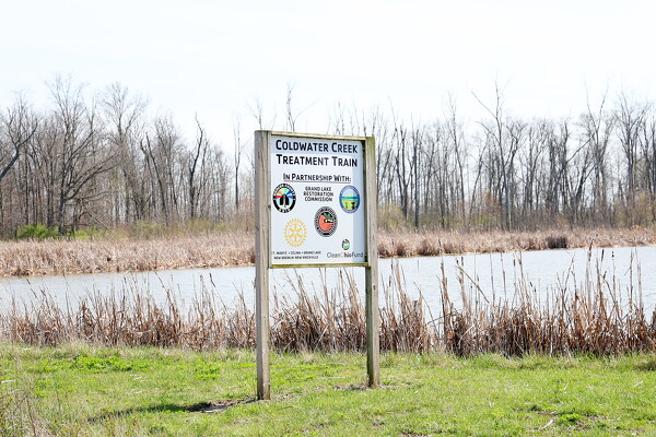
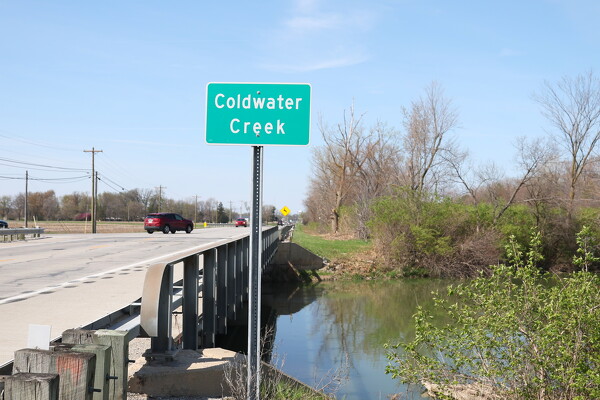
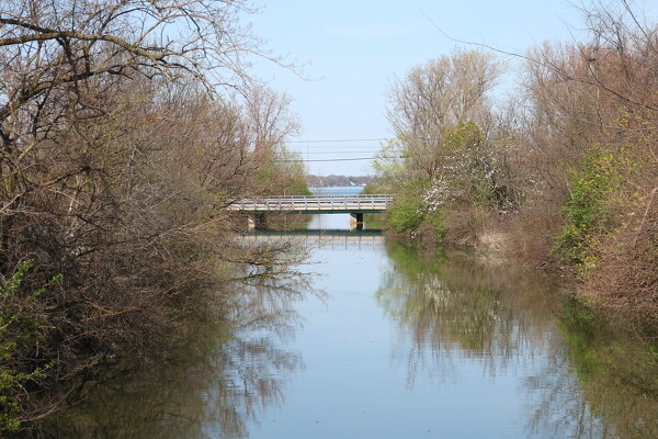
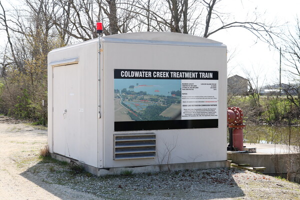
Published article highlights local water quality efforts
CELINA - Area experts working to restore the water quality of Grand Lake have authored a study demonstrating the efficacy of restored and managed [More]
MINSTER - The state biennium budget as it was passed by the House this month could reduce Minster Local Schools' savings by around $5 million, treasurer Gina Selby warned at Tuesday night's regular school board meeting.
Ohio's unemployment rate rose slightly in March to 4.8% from 4.7% in February, and area counties saw either slight increases or decreases in joblessness, with some experiencing no change at all.
CHILLICOTHE - Citing discussions with "government officials" and an undisclosed "potential public-private partnership," Pixelle Specialty Solutions abruptly changed course April 18 on the previously announced closing of its Chillicothe paper mill.